This is something that Las Palmas do not want to talk about. Placing recreational activities on the public bed of a ravine, no matter how many channels there are, is a risk for industry and for human activity. The south of Gran Canaria has been intensely transformed by tourist facilities since 1962. Among the environmental consequences of this process, flooding stands out. This study aims to determine whether there is a relationship between tourist establishments and the increase in damage caused by flooding in recent decades. A diachronic analysis has been carried out between 1962 and the present, comparing the evolution of episodes of intense rain and the problems generated. Like El Veril, the Las Burras area has been configured on multiple occasions as a ground zero due to the effects of the ravine in the south of Gran Canaria.
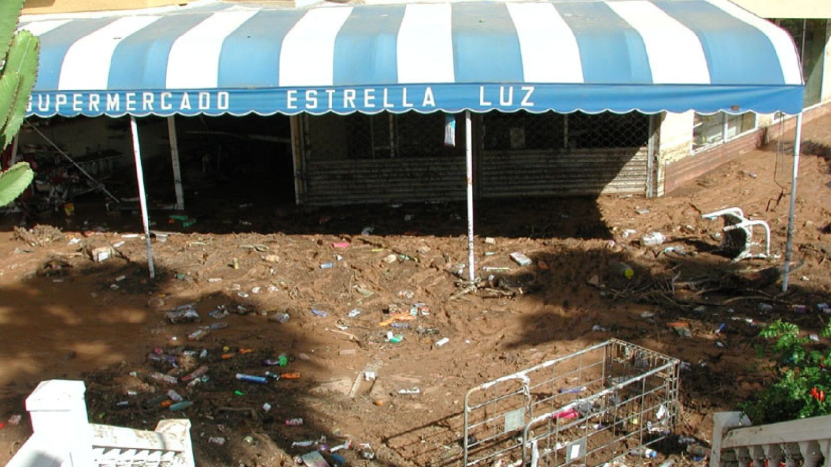
Cold drops have had a significant impact on southern Gran Canaria throughout history. These meteorological phenomena, characterized by torrential and sudden downpours, have caused flooding and considerable damage in the region. Some historical cold drop events in southern Gran Canaria occurred in 2010, 2014, and 2019, requiring special attention for residents and causing significant damage to infrastructure. A study by Pablo Máyer Suárez, Emma Pérez-Chacón Espino, and Lidia Esther Romero Martín, from the University of Las Palmas de Gran Canaria (ULPGC), entitled " Rain and Flooding in the Tourist Centers of Gran Canaria: The Case of San Bartolomé de Tirajana ," warns of the risks in areas like El Veril because, in the past, "flooding was due to the overflowing of the ravine, which collects water from other watercourses," given that the area under the GC-500 highway cannot evacuate floodwaters.
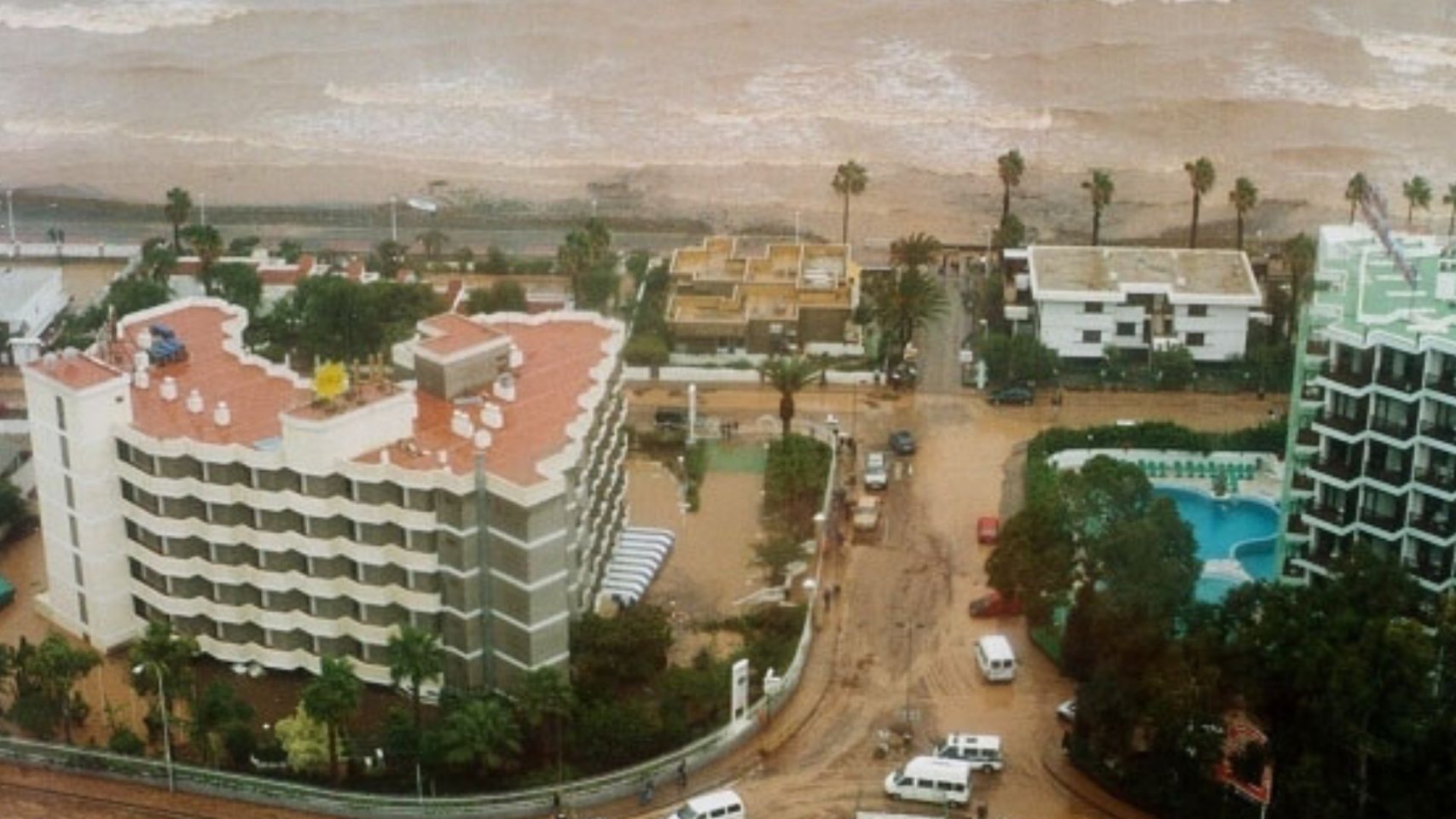
The results indicate that the recent increase in damages caused by flooding is explained by the way in which urban growth and associated tourist infrastructure have been carried out. The first references to material losses caused by flooding in tourist facilities date back to 1979, although the best quantified ones are those derived from the storms of January 2000 and November 2001.
Between 1962 and 1972, the press did not record any significant damage, despite the construction of various housing estates and the occurrence of some storms. However, as early as 1979, with daily rainfall close to 30 mm, damage was reported. This damage increased progressively in subsequent years (1984, 1991, 1995, 1996, 2000 and 2001), both in magnitude and frequency. "The main problems occurred both on the roads and in the hotels and apartments in this tourist area of Gran Canaria," the report states.
The main communication route, the GC-500, between the Aeroclub and Playa del Inglés, faces the following challenges: dragging of eroded materials by runoff waters and landslides from the upper slope to the road, overflows from pontoons built on channels in Las Burras and San Agustín, flooding of underground passages and other roads in the tourist area also have flooding problems, especially those with depressed passages that are completely flooded. In addition, the apartments pour rainwater directly onto the roads, which causes flooding in basements and car parks. Flooding and mud deposits affect the buildings located in Las Burras and El Veril, between the sea and the GC-500, due to the inability of the pontoons to drain flood waters and the lack of conservation of these elements and cleaning of channels.